Windows Placecards
Contextual Location Cards in Windows


This was a 3-month project and I worked with Product Management and Development throughout this process.
- Primary & Secondary Research
- Sketching, UI Design, Prototyping
- User Testing, Design Maintenance, Redlining
Process
For this feature, I surveyed card-like controls across several different platforms to understand what types of information and calls-to-action were displayed and prioritized. I chose competitors based on their size of the respective user bases.
What types of information are important to users in regards to a specific location?
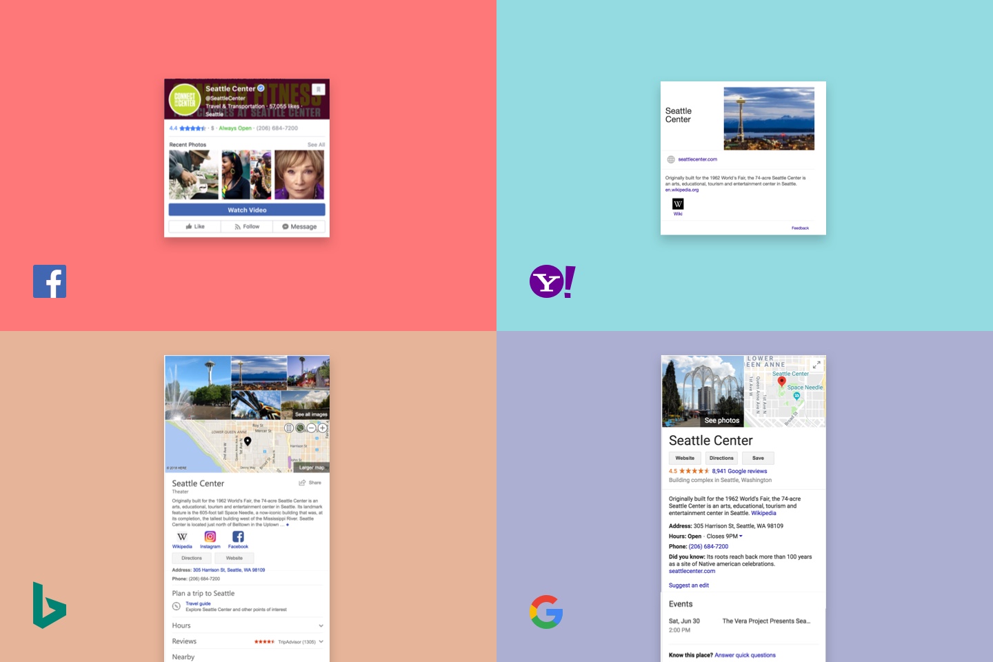
As a result of this competitive analysis, I found that most cards contained some basic information such as:
- Name
- Photo(s)
- Summary
- Rating
- Website
Each platform then differed on some other pieces of functionality that aligned with their business goals.
This competitive analysis also brought up some additional questions and inquiries.
"How does this priority of information change per location?"
To answer these questions, I teamed up with the central research team to conduct a survey of 22 participants. This survey helped to understand the types of information or features that people would prioritize based on different location types
(e.g. restaurants vs a museum)
Results of the survey showed that:
- Participants want real-time status updates for all places
- Information found in Yelp© was most wanted
- Participants did not care for multimedia or social features
From there, I went to preliminary ideation and sketching, taking from what I saw in the competitive analysis as a starting point.
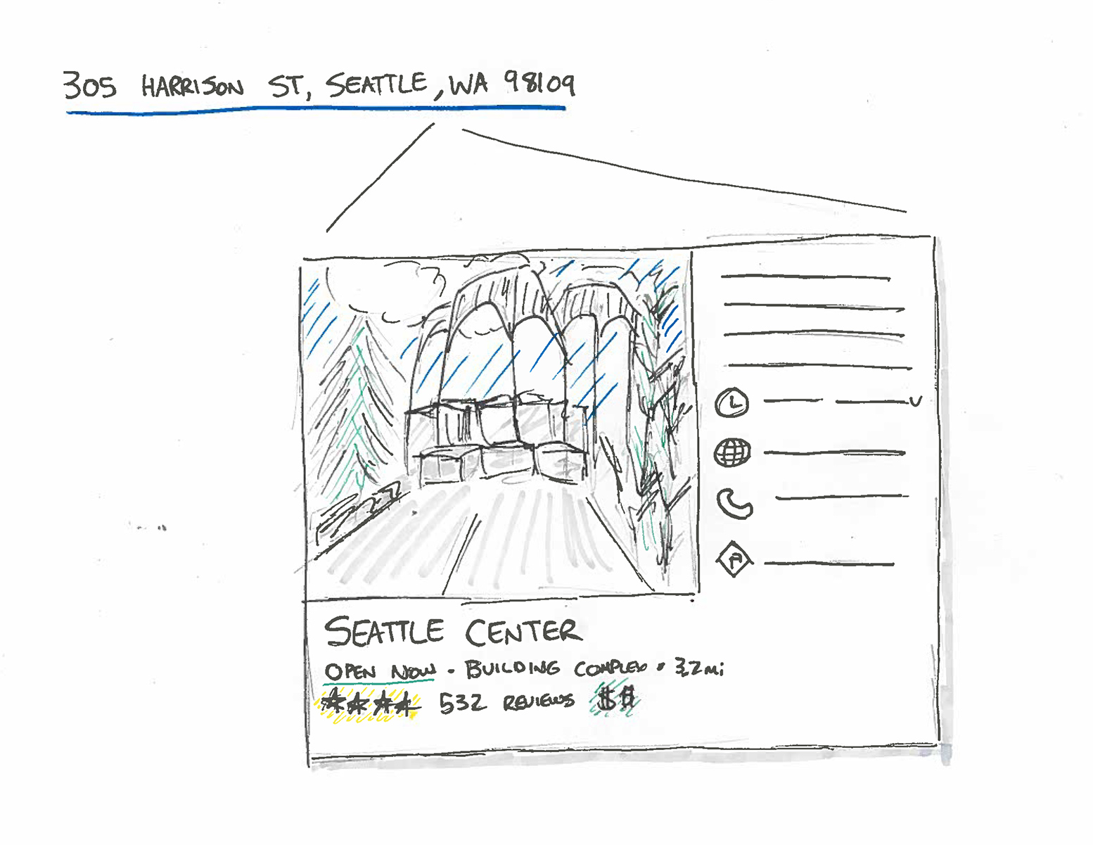
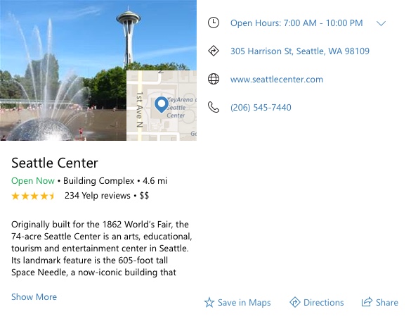
The final design reflects the findings we had in our research as well as some of the business and technical constraints I was presented with. Based on the data given for each of type of location, we can display:
- Interactive Map
- Name
- Status
- Summary
- Open Hours
- Links
- Photos
- CTA for Maps Application Actions
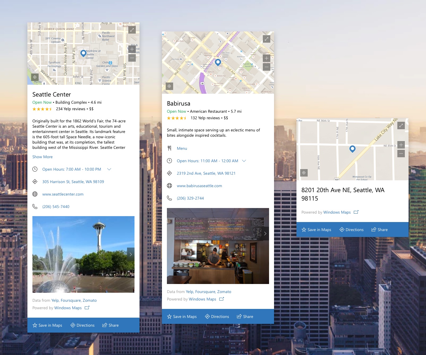
Below is a prototype of the interaction with the Sticky notes application on Windows. This prototype was built in Framer and used to showcase how the interaction would work from Sticky notes as well as how the Placecard would interact based on user input.
Outcome
Our team was able to design and develop a control that provides contextual location information for users without needing to open an Internet browser. This also allows Windows as an operating system to become more aware of location entities. By using the Windows Map Platform as a foundation for this feature, we were also able to leverage its feature and data set while helping to increase engagement to that application. Placecards was first launched with integrating with Sticky Notes, and looks to become more prevalent across more use cases in Windows.
